
The way of Saint-Regis (GR 430) is a hike in loop starting from Le Puy-en-Velay, which can be travelled in 9 days. Of a total distance of 201 km, this hike will make you follow the steps of John Francis Regis, patron saint of the lacemakers. You will go by the plateaus of the Velay, Mézenc and Vivarais but also the Massif Central.
Your stopovers on the way of Saint-Régis GR 430
Below, we suggest you some ideas of strolls following the way of Saint Régis. These ones allow you to do some loops of 4 and 9 days.
Way of Saint-Régis in 9 days, from Le Puy-en-Velay (complete hike)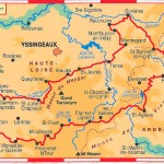
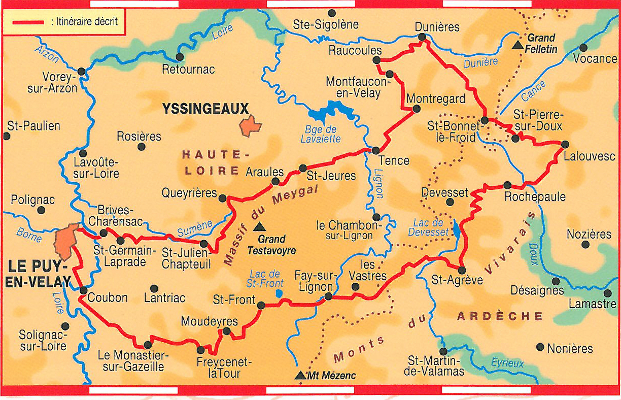
- Day 1: from Le Puy-en-Velay to Le Monastier-sur-Gazeille: 19.5 km (5h of hike)
- Day 2: from Le Monsatier-sur-Gazeille to Saint-Front: 22 km (5h30 of hike)
- Day 3: from Saint-Front to Saint-Agrève: 28 km (7h of hike)
- Day 4: from Saint-Agrève to Lalouvesc: 27.5 km (6h45 of hike)
- Day 5: from Lalouvesc to Saint-Bonnet-le-Froid: 17 km (4h15 of hike)
- Day 6: from Saint-Bonnet-le-Froid to Dunières: 17 km (4h15 of hike)
- Day 7: from Dunières to Tence: 23.5 km (5h45 of hike)
- Day 8: from Tence to Queyrières: 19.5 km (4h45 of hike)
- Day 9: from Queyrières to Le Puy-en-Velay: 28.5 km (7h15 of hike)
4 days of hike in loop from Le Puy-en-Velay (GR 430 Way of Saint-Régis and GR 40 Tour of the volcanoes of the Velay)
Warning: to travel this loop, you will need to complete your guidebook of the Way of Saint-Régis GR 430 with the guidebook of the Tour des Volcans du Velay (GR 40) or with the IGN map Le Puy – Yssingeaux 2835 OT.
- Day 1: from Le Puy-en-Velay to Le Monastier-sur-Gazeille: 19.5 km (5h of hike)
- Day 2: from Le Monastier-sur-Gazeille to Saint-Front: 22 km (5h30 of hike)
- Day 3: from Saint-Front to Saint-Julien-Chapteuil: 19.5 km (4h50 of hike)
- Day 4: from Saint-Julien-Chapteuil to Le Puy-en-Velay: 19 km (4h45 of hike)
Accommodation and other services
On the way of Saint-Régis, many accommodations are at your beck and call: bed and breakfast, stopover gîtes, campsites or even hotels. You will find the listing of these service providers in the TopoGuide, the useful booklet of the accommodations or even our page dedicated to the accommodations. Do not hesitate to contact them and from now on book your stay.
For the transportation of your luggage, or to travel further away on the path, la Malle Postale offers this hike in their catalog. You can also consult our other service providers who will establish a cost estimate on demand.
The TopoGuide of the way of Saint-Régis GR 430

The guidebook contains the chart of the services to plan your stopovers, a listing of the accommodations, the IGN maps and the description step by step of the path as well as theme sheets about the fauna, flora, heritage… It is compulsory to prepare your hike and follow the itinerary day after day.
The IGN maps of the itinerary
The IGN maps are included in the guidebook. Nevertheless, if you wish to move away from the markings, the related IGN maps are the following ones:
- 2835 OT Le Puy – Yssingeaux
- 2836 OT Le Mézenc – Gerbier-de-Jonc
- 2936 O Le Cheylard (of little help)
- 2835 OT Le Chambon-sur-Lignon – Saint-Agrève
- 2934 ET Bourg-Argental (only for Dunières)
- Overview on the IGN map, scale 1 : 100 000, ref. 156 Le Puy – Privas
To order your maps, check out our online shop. If in doubt or if you need advice, do not hesitate and contact us.
Access to the Way of Saint-Régis GR 430
The simplest access to the Way of Saint Régis is situated in Le Puy-en-Velay where it’ll be easy to come by car or train. Some possibilities of parking lots adapted to the walkers are available in the city of Le Puy-en-Velay, check out our page about how to come to Le Puy-en-Velay.