Between Haute-Loire and Lozère, a spectacular hike
The GR 470 Sources and gorges of Allier goes back up the river Allier from Brioude to its source in the Moure-de-la-Gardille in 11 stop-overs of about 20 km. Between the plains of the Haut-Allier and its inaccessible gorges, this GR will offer you some wild and unforgettable memories!
The itinerary of the GR 470 Sources and gorges of Allier
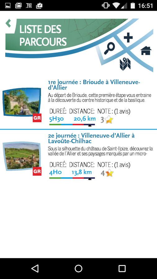
From Brioude in the plains of Limagne, the GR 470 Sources and gorges of Allier enters quite quickly in the “Haut Allier”, in Vieille-Brioude, it reaches the castle of Saint-Ilpize which guards the access of the gorges of Allier then reach the “loop” of the river where nest Lavoûte-Chilhac.
Then Chilhac, market town with a medieval appearance, built on a lava flow with monumental basalt columns.
Then comes Langeac, a break in the steep relief, before plunging back in the gorges where Chanteuges, Saint-Arcons-d’Allier and Prades protect their treasures of architecture and geology.
Sometimes, at the river side, along the gravel pits where the salmons come to spawn, sometimes along the hillsides, when the gorges become unattainable, this itinerary crosses the villages of Pont-d’Alleyras, Monistrol-d’Allier, Le Nouveau Monde then reaches Langogne and ends by the ascent of the Moure-de-la-Gardille where the river emerge.
It even continues a bit to reach the train station of La Bastide-Puylaurent, in Lozère.
To travel on the GR 470
The GR 470 Sources and gorges of Allier is the first long-distance hike to be available 100% free, under a digital format. Three possibilities to walk on this GR:
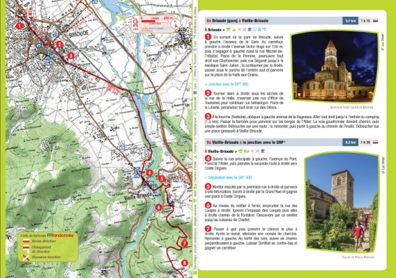
- The digital Randofiches®, freely downloadable on our consecrated page. Each Randofiche* includes a IGN map, a detailed description of the itinerary, some information about the accommodation, the distances and times of walking as well as explanatory sheets about your walk. Once downloaded, you’ll be able to freely print them or store them on your tablet computer or smartphone.
- The GPS tracks, freely downloadable on our consecrated page. Each stop-over owns its GPS track downloadable on .GPX format (standard format of the GPSs and modern software). Once downloaded, you’ll be able to freely forward them on you walking GPS.
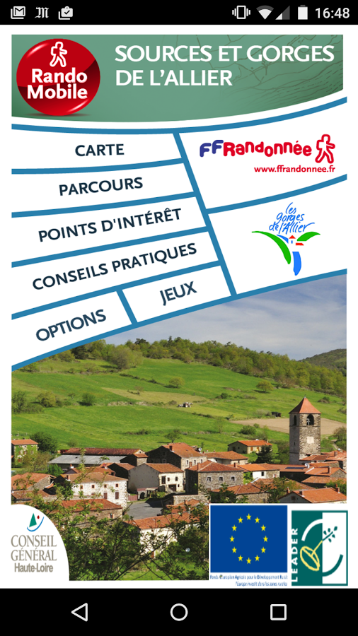
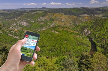
- For your smartphone, the app is freely downloadable on the usual platform GooglePlay or AppStore. The app will offer you the necessary piece of information to follow the GR 470 with your smartphone: background IGN maps, step-by-step for each stop-over, all the points of interest of the hike geotagged (accommodation, tour, services, etc.), photographs, videos and much more…
*Note: the term Randofiche® designates a field-based tool which allows to cross a hike in loop, including an IGN map and all the necessary information.