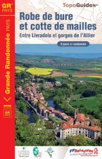
This walk, of an unlikely name, is made for lovers of landscapes and especially heritage! In 9 days of hike and 163 km, you will go in the gorges of Allier, between Langeac and Saint-Arcons-d’Allier, then will enter the Livradois-Forez Regional Natural Park to join the medieval village of Allègre, then La Chaise-Dieu and its unavoidable abbey. Will then come the rolling footpaths along the Senouire, with the castle of Domeyrat or even the octagonal steeple of the church of Lavaudieu.
The GRP Robe de bure et cotte de mailles is a loop of 163 km which can be covered in 9 days, in accordance with the stopovers mentioned below. The average length of a stop-over is about 18 km, which makes it a GR accessible for everyone.
Of course, these stop-overs can be changed according to your capacities and of the accommodations available.
Different types of accommodations are available on this long-distance hike: bed and breakfast, stopover gîtes, campsites or even hotels. You will find a list of these service providers in the TopoGuide, the guidebook of useful information or even in our page dedicated to the accommodations. Do not hesitate to contact them to book your stay as of now.
The service providers as the luggage or people carriers are not really developed on this walking trail. Nevertheless, you can contact one of our partners that will draw up a quote for you. On request, some hosts can sometimes provide this kind of service.
The guidebook is the mandatory element to prepare you walk on the GRP “Robe de bure et cotte de mailles”. It contains a supply table to prepare your stop-overs, a list of the accommodations, IGN maps and the description step by step of the path, as long as some factsheets about the fauna, flora, heritage, etc.
In case of “off-trail”, you can complete your guidebook with the following IGN maps, scale 1 : 25 000:
The items above are available on our online shop or directly in our shop in Le Puy-en-Velay.
The municipality of Langeac is situated on the banks of the river Allier, West of Haute-Loire and gather around 3800 inhabitants. It’s the starting point of the GRP Robe de bure et cotte de mailles which heads towards the South, in the direction of Pébrac then Chanteuges.
From Le Puy-en-Velay, around 40 minutes of car are necessary to reach Langeac. If you’re coming from Lyon, is around 2h20.
And from Clermont-Ferrand, you will need around 1h20. Let yourself be led by the map below.


Nice, but are there any eco friendly means of transportation to arrive in Langeac, and or the departure of the trail? Thanks and best regards, Emile.
I.e. this information is lacking in this page!
Hello Emile, the trail starts from Langeac and you can go there by train. You’ll find their contact information in our “Guide Pratique” downloadable on the GRP’s page, as well as other information for group transportation. If you need further information, do not hesitate to directly contact us by mail : https://www.rando-hauteloire.fr/contactez-nous/
Best regards.
Ce tour est il balisé dans les deux sens ?
Thierry Bécot
Bonjour, Oui le GRP Robe de Bure et Cotte de Mailles est balisé dans les deux sens comme tous les GR, GRP et PR. Cordialement, Mélissa.
Bonjour, est-il nécessaire/préférable de réserver tous les logements si on fait la rando en mai? Merci. Marina
Bonjour,
Non ce n’est pas nécessaire, il n’y a pas beaucoup de monde sur ce GRP.
Bonjour, quel est le meilleur mois pour randonner sur ce GRP? Merci, Marina.
Bonjour,
La plupart des hébergements ouvrent du 1er Avril au 30 Octobre, vous pouvez donc le faire pendant cette période.
Nous vous recommandons la période Mai – Juin.
Bonne journée.
Bonjour,
Est-il,possible de télécharger la trace GPX de ce GRP?
Merci pour votre réponse.
Bernard
Bonjour,
La trace GPX du GRP est disponible sur notre application mobile Rando en Haute-Loire téléchargeable gratuitement sur Android ou iOS
Bonne journée.
Ce serait bien “FFrandonnée de Haute-Loire” de préciser dès le départ que ce GR est accessible en train : gare de Langeac. C’est un point important pour les randonneurs.
Bonjour,
L’information est déjà présente dans notre Topoguide Robe de bure et cotte de mailles.
Bonne journée.
Bonjour. Y a t il de garer gratuitement sa voiture à Langeac ? Je ferais le circuit avec ma chèvre qui m’accompagne dans mes randos. Est-ce possible ou bien traversons nous des parcs qui l’interdisent ?
Dernière question. Je pensais dormir en bivouac. Y a t il des contre indications sur ce circuit ? Belle journée
Bonjour,
Vous pouvez vous garer gratuitement sur Langeac, soyez vigilant aux différents événements estivaux qui pourraient amenés à déplacer votre véhicule, contactez l’Office de Tourisme ou la Mairie pour être sûr de ne pas gêner.
Vous pouvez randonner avec votre chèvre sans problèmes.
Il n’y a pas de contre indications particulières pour le bivouac
Bonne journée
Bonjour.
Généralement dans les topo guides de la FFR il n’y a pas de dénivelés.
C’est bien dommage car compter en temps sans tenir compte du dénivelé cela peu prêter à confusion.
Comment pouvons-nous inciter les publications papier à rajouter le dénivelé ?
C’est tout de même important !
Bien cordialement
Bonjour, la fédé est au courant, nous le faisons remonter depuis plusieurs années qu’il faudrait les dénivelés. Ils sont en cours de réflexions. Les prochaines éditions dans les années à venir vont en être pourvues normalement.
Cordialement.
Bjr,
Pour les randonneurs itinérants sur le “Robe de bure et cotte de mailles” sur la portion Chadernac-Chanteuges, entre la Croix de fer et le pont de la Desges; une piste est en cours de terrassement et les balises ont été toutes enlevées (arbres dégagés!).
Ne quittez pas cette piste assez pentue sur 1km500 sans bifurquer. Idem pour le retour.
Une fiche-info va être mise en place à la croix de fer ainsi qu’au pont de la Desges. Michel Baliseur
Bonjour,
je souhaite faire quelques étapes de ce GR avec mon chien. Est-ce possible ou certains secteurs sont ils interdits aux chiens ?
Bonjour,
Oui il est tout à fait possible de faire cet itinéraire avec un chien. Nous vous recommandons de le tenir en laisse à proximité des exploitations agricoles.
Bonne journée.
Chemin fait début mai 2025 en 9 jours
Superbe parcours…un peu frais (2°C à Chavaniac- Lafayette) Peu fréquenté ; bien prévoir le ravitaillement car peu de commerces
Accueil super à l’auberge de St Didier sur Doulon mais en fait partout !!!
Bonjour,
Merci pour votre retour !
Bonne journée