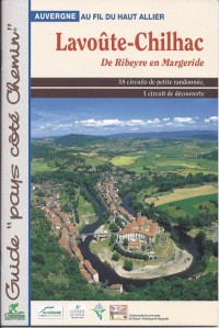
Located at the West of Haute-Loire, territory of Lavoûte-Chilhac is crossed by the Allier, one of the last wild river of Europe. With this guidebook of walks, you’ll discover 18 tours of small walks at the edge of the Allier and on the plateaus of the Ribeyre and Margeride. These strolls will lead you to a remarkable heritage.
While travelling these tours, you will discover several sites remarkable by their heritage. Some churches and chapels are ornamented with painting from the medieval era (Blassac, Saint-Ilpize, and Saint-Cirgues). One can observe the silhouettes of some castles dating form this time. The village of Chilhac, partly built on a basaltic lava flow, is an impressive point of this territory, as well as for Lavoûte-Chilhac and its priory lined by the Allier.
The rambles proposed in this guidebook have a length sets from 30 minutes to 4h50. They are accessible by almost everybody and are maintained and marked in yellow by the local council community. Each walk of this guide includes excerpt of a topographical IGN map with the track of the tour and a detailed description of the route. One also finds thematic pages about the heritage, the landscapes, fauna and flora…
Cliquez sur les marqueurs pour afficher le détail du circuit